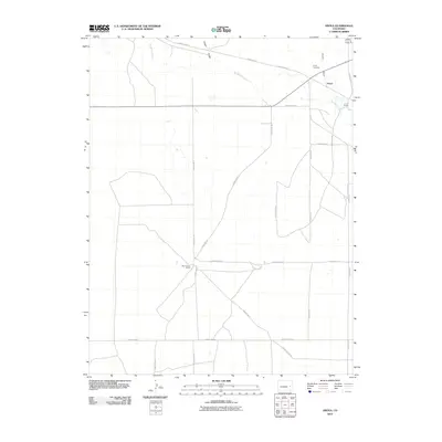
2010 Map of Aroya
USGS Topo · Published 2010About this map
Aroya and its surrounding plains are defined by an expansive grid of county roads and the persistent drainage patterns of the High Plains. This 2010 survey illustrates a landscape of large-scale ranching operations, including the Rush Creek Ranch and J O D Ranch, which anchor the local geography. The settlement at Aroya is situated near the northern edge of the map, adjacent to Aroya Gulch and the Aroya Cemetery. The natural topography is marked by the meandering path of Big Sandy Creek, which cuts across the northeastern corner. This map provides a detailed view of the modern rural infrastructure, showing how historic cattle-country land divisions persist into the 21st century through an intricate network of thoroughfares like County Rd 44 and County Road U.
Find a feature on this map
24 named features on this map. Tap any name to fly to it.
Don’t see what you’re looking for? This feature index may not catch every label — zoom into the map to look around manually.
Map Details
Editions of this 2010 Aroya Map
This is the sole edition of this map. No revisions or reprints were ever made.
Other maps of this area

1891 · Arroyo
USGS Topo · 1:125,000

1893 · Arroyo
USGS Topo · 1:125,000

1954 · Lamar
USGS Topo · 1:250,000

1958 · Lamar
USGS Topo · 1:250,000

1978 · Galatea NE
USGS Topo · 1:24,000

1978 · Aroya
USGS Topo · 1:24,000

1978 · Barrel Springs Draw
USGS Topo · 1:24,000

1978 · Rock Basin
USGS Topo · 1:24,000

1978 · Sanders Ranch
USGS Topo · 1:24,000

1978 · Stacy Lakes Draw
USGS Topo · 1:24,000