2016 Map of Aroya
USGS Topo · Published 2016About this map
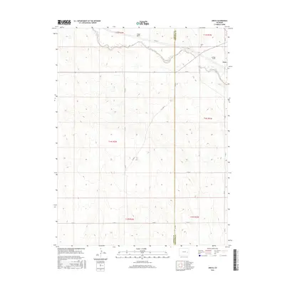
Big Sandy Creek winds through this high plains landscape, defining the local geography as it crosses the border between Lincoln and Cheyenne counties. The small settlement of Aroya sits on the eastern edge of the quadrangle, serving as a primary point of reference in an area otherwise characterized by its wide-ranging township and range divisions. The map provides a critical record for genealogists and local historians by identifying the Aroya Cem just west of the town site. This 2016 survey illustrates the persistent pattern of rural section-line roads, including Co RD 39 and Co RD U, which connect the isolated homesteads and ranch lands that populate the region. Natural drainage features such as Folger Gulch and Aroya Gulch highlight the subtle relief of the terrain north of the creek.
Find a feature on this map
23 named features on this map. Tap any name to fly to it.
Don’t see what you’re looking for? This feature index may not catch every label — zoom into the map to look around manually.
Map Details
Editions of this 2016 Aroya Map
This is the sole edition of this map. No revisions or reprints were ever made.
Other maps of this area

1891 · Arroyo
USGS Topo · 1:125,000

1893 · Arroyo
USGS Topo · 1:125,000

1954 · Lamar
USGS Topo · 1:250,000

1958 · Lamar
USGS Topo · 1:250,000

1978 · Galatea NE
USGS Topo · 1:24,000

1978 · Aroya
USGS Topo · 1:24,000

1978 · Barrel Springs Draw
USGS Topo · 1:24,000

1978 · Rock Basin
USGS Topo · 1:24,000

1978 · Sanders Ranch
USGS Topo · 1:24,000

1978 · Stacy Lakes Draw
USGS Topo · 1:24,000