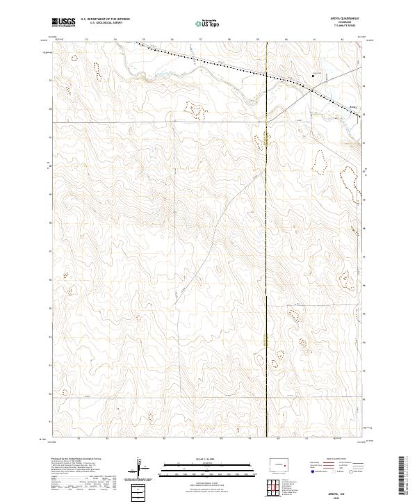
2022 Map of Aroya
USGS Topo · Published 2022About this map
Big Sandy Creek defines the northern landscape of this eastern Colorado plains region, winding through a valley marked by Folger Gulch and Aroya Gulch. The small settlement of Aroya is situated near the junction of these drainages and the rail line, serving as a quiet focal point for the surrounding ranching and agricultural lands. Genealogists and local historians can locate the Aroya Cem north of the townsite, a significant landmark for tracing early families in this part of Lincoln County. The map reveals a transition into Cheyenne County to the east, with a network of rural roads such as Co RD 47 and Co RD W following the section lines of the Public Land Survey System, illustrating the enduring grid of the High Plains.
Find a feature on this map
21 named features on this map. Tap any name to fly to it.
Don’t see what you’re looking for? This feature index may not catch every label — zoom into the map to look around manually.
Map Details
Editions of this 2022 Aroya Map
This is the sole edition of this map. No revisions or reprints were ever made.
Other maps of this area

1891 · Arroyo
USGS Topo · 1:125,000

1893 · Arroyo
USGS Topo · 1:125,000

1954 · Lamar
USGS Topo · 1:250,000

1958 · Lamar
USGS Topo · 1:250,000

1978 · Galatea NE
USGS Topo · 1:24,000

1978 · Aroya
USGS Topo · 1:24,000

1978 · Barrel Springs Draw
USGS Topo · 1:24,000

1978 · Rock Basin
USGS Topo · 1:24,000

1978 · Sanders Ranch
USGS Topo · 1:24,000

1978 · Stacy Lakes Draw
USGS Topo · 1:24,000