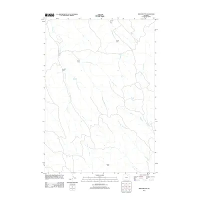
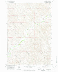
2012 Map of Arpan Butte
USGS Topo · Published 2012About this map
Arpan Butte rises above a landscape defined by an intricate network of seasonal drainage and water management in this Sheridan County quadrangle. The map reveals the ranching-driven geography of the early 21st century, where water access is facilitated by the Bill Yates Reservoir and the winding course of the Thompson Fork. The terrain is characterized by numerous named draws, including Number 1 Draw, Corner Draw, and Redman Draw, which provide critical insight into the local topography and historical naming conventions of the region.
Find a feature on this map
11 named features on this map. Tap any name to fly to it.
Don’t see what you’re looking for? This feature index may not catch every label — zoom into the map to look around manually.
Map Details
Editions of this 2012 Arpan Butte Map
This is the sole edition of this map. No revisions or reprints were ever made.
Other maps of this area

1955 · Sheridan
USGS Topo · 1:250,000

1958 · Sheridan
USGS Topo · 1:250,000

1962 · Sheridan
USGS Topo · 1:250,000
1971 · Clearmont
USGS Topo · 1:24,000

1971 · Arvada
USGS Topo · 1:24,000

1971 · Leiter
USGS Topo · 1:24,000
1971 · Julio Draw
USGS Topo · 1:24,000

1972 · Mitchell Draw
USGS Topo · 1:24,000
1972 · Jewell Draw
USGS Topo · 1:24,000
1972 · Floate Draw
USGS Topo · 1:24,000