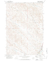
1971 Map of Clearmont
USGS Topo · Published 1974About this map
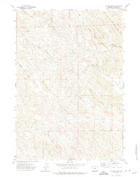
Clearmont serves as the primary hub in this Sheridan County landscape, situated where the Burlington Northern railroad meets the confluence of several vital watercourses. The map captures a moment in the early 1970s when the town's local infrastructure included an Athletic Field and a nearby Gravel Pit, signifying small-town development along the rail line. The surrounding terrain is defined by an intricate network of drainage patterns, including Lone Tree Creek, Whitmeyer Creek, and Pinhead Creek, which feed into the larger Clear Creek valley.
Find a feature on this map
17 named features on this map. Tap any name to fly to it.
Don’t see what you’re looking for? This feature index may not catch every label — zoom into the map to look around manually.
Map Details
Editions of this 1971 Clearmont Map
This is the sole edition of this map. No revisions or reprints were ever made.
Other maps of this area

1909 · Sheridan
USGS Topo · 1:125,000

1911 · Sheridan
USGS Topo · 1:125,000

1955 · Sheridan
USGS Topo · 1:250,000

1958 · Sheridan
USGS Topo · 1:250,000

1962 · Sheridan
USGS Topo · 1:250,000
1970 · Ulm
USGS Topo · 1:24,000
1970 · Ucross
USGS Topo · 1:24,000
1970 · S R Springs
USGS Topo · 1:24,000
1971 · Shuler Draw
USGS Topo · 1:24,000

1971 · Gardner Gulch
USGS Topo · 1:24,000