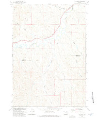
1971 Map of Julio Draw
USGS Topo · Published 1975About this map
Clear Creek meanders through a landscape defined by drainage patterns and early irrigation efforts in northern Wyoming. The Pratt and Ferris Ditch No 1 cuts across the terrain, illustrating the historical reliance on managed water systems to support land use in this arid region. Near the northern boundary, the Burlington Northern railroad corridor parallels Lone Tree Creek, marking the primary transportation artery through the area.
Find a feature on this map
12 named features on this map. Tap any name to fly to it.
Don’t see what you’re looking for? This feature index may not catch every label — zoom into the map to look around manually.
Map Details
Editions of this 1971 Julio Draw Map
This is the sole edition of this map. No revisions or reprints were ever made.
Other maps of this area

1900 · Fort McKinney
USGS Topo · 1:125,000

1903 · Fort McKinney
USGS Topo · 1:125,000

1909 · Sheridan
USGS Topo · 1:125,000

1911 · Sheridan
USGS Topo · 1:125,000

1955 · Sheridan
USGS Topo · 1:250,000

1958 · Sheridan
USGS Topo · 1:250,000

1962 · Sheridan
USGS Topo · 1:250,000

1970 · Buffalo NE
USGS Topo · 1:24,000
1970 · Ulm
USGS Topo · 1:24,000
1970 · Ucross
USGS Topo · 1:24,000