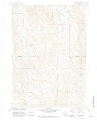
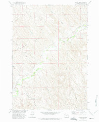
1972 Map of Arpan Butte
USGS Topo · Published 1975About this map
Arpan Butte dominates the southern landscape of this 1970s topographic survey, marking a distinct terrain feature in a region defined by an intricate network of drainage channels. The area exhibits a classic Western watershed pattern where numerous ephemeral draws, such as Redman Draw, Long Draw, and Fowler Draw, feed into larger systems like Thompson Creek. Human modification of this arid environment is evident at the Bill Yates Reservoir, a critical water management point located near East Fork Thompson Creek. The map also delineates the boundary between Sheridan Co and Johnson Co, providing a clear record of administrative borders as they intersected the natural topography during the early 1970s. This survey is particularly useful for understanding local hydrology and land use before later twentieth-century developments.
Find a feature on this map
17 named features on this map. Tap any name to fly to it.
Don’t see what you’re looking for? This feature index may not catch every label — zoom into the map to look around manually.
Map Details
Editions of this 1972 Arpan Butte Map
This is the sole edition of this map. No revisions or reprints were ever made.
Other maps of this area

1955 · Sheridan
USGS Topo · 1:250,000

1958 · Sheridan
USGS Topo · 1:250,000

1962 · Sheridan
USGS Topo · 1:250,000
1971 · Clearmont
USGS Topo · 1:24,000

1971 · Arvada
USGS Topo · 1:24,000

1971 · Leiter
USGS Topo · 1:24,000
1971 · Julio Draw
USGS Topo · 1:24,000

1972 · Mitchell Draw
USGS Topo · 1:24,000
1972 · Jewell Draw
USGS Topo · 1:24,000
1972 · Floate Draw
USGS Topo · 1:24,000