
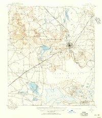
1890 Map of Arredondo
USGS Topo · Published 1955This historical map portrays the area of Arredondo in 1890, primarily covering Alachua. Featuring a scale of 1:62500, this map provides a highly detailed snapshot of the terrain, roads, buildings, counties, and historical landmarks in the Arredondo region at the time. Published in 1955, it is one of 2 known editions of this map due to revisions or reprints.
Find a feature on this map
69 named features on this map. Tap any name to fly to it.
Don’t see what you’re looking for? This feature index may not catch every label — zoom into the map to look around manually.
Map Details
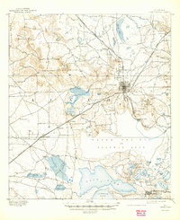
Editions of this 1890 Arredondo Map
2 editions found
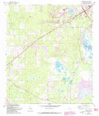
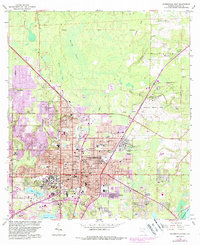
Historical Maps of Arredondo Through Time
14 maps found
1890 Arredondo
Alachua County, FL

1892 Arredondo
Alachua County, FL
1894 Arredondo
Alachua County, FL

1938 Hawthorn
Alachua County, FL

1943 Hawthorn
Alachua County, FL
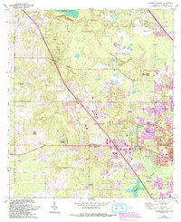
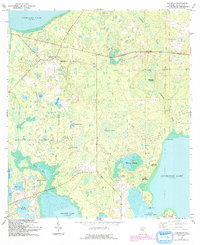
1966 Arredondo
Alachua County, FL
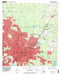
1966 Gainesville East
Alachua County, FL
1966 Gainesville West
Alachua County, FL
1966 Melrose
Alachua County, FL
1966 Monteocha
Alachua County, FL
1966 Orange Heights
Alachua County, FL
1966 Rochelle
Alachua County, FL
1994 Gainesville East
Alachua County, FL
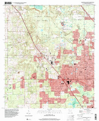
1994 Gainesville West
Alachua County, FL