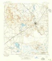
1890 Map of Arredondo
USGS Topo · Published 1956About this map
Gainesville serves as the central hub for a complex network of 19th-century railroads, including the Peninsular Rail Road and the Florida Central and Western Rail Road. This 1890 survey illustrates a landscape defined by its distinctive karst topography, where numerous sinks and depressions like Devils Mill Hopper, Warren Cave, and Hickory Sink punctuate the terrain. The presence of Alachua Lake and Payne Prairie indicates the area's shifting hydrology, while smaller settlements such as Arredondo, Kanapaha, and Micanopy are established along the burgeoning rail lines.
Find a feature on this map
65 named features on this map. Tap any name to fly to it.
Don’t see what you’re looking for? This feature index may not catch every label — zoom into the map to look around manually.
Map Details
Editions of this 1890 Arredondo Map
2 editions found
Other maps of this area

1890 · Arredondo
USGS Topo · 1:62,500

1892 · Arredondo
USGS Topo · 1:62,500

1893 · Citra
USGS Topo · 1:62,500

1894 · Arredondo
USGS Topo · 1:62,500

1895 · Williston
USGS Topo · 1:62,500

1895 · Citra
USGS Topo · 1:62,500

1938 · Hawthorn
USGS Topo · 1:48,000

1941 · Starke
USGS Topo · 1:62,500

1943 · Hawthorn
USGS Topo · 1:62,500

1948 · Starke
USGS Topo · 1:50,000