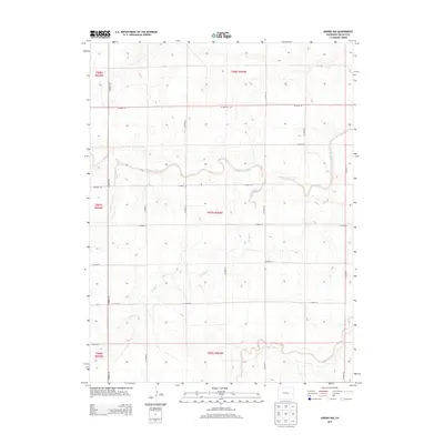
2013 Map of Arriba NW
USGS Topo · Published 2013About this map
The Arikaree River carves a meandering course through this section of the High Plains, illustrating the hydrological patterns of Lincoln County. This 2013 survey provides a clear look at the agricultural grid of the Eastern Plains, where section lines are defined by an extensive network of county roads such as CO Road 109 and CO Road 37. The landscape is etched by intermittent drainage systems including Lickdab Cr, Currie Creek, and Dugout Creek, which feed into the primary river valley. These watercourses dictate the subtle variations in elevation across the terrain, serving as vital landmarks for property boundaries and land management in this rural Colorado environment. The map details the Public Land Survey System (PLSS) divisions, showcasing the precise township and range structure that has governed land ownership in the region since settlement.
Find a feature on this map
24 named features on this map. Tap any name to fly to it.
Don’t see what you’re looking for? This feature index may not catch every label — zoom into the map to look around manually.
Map Details
Editions of this 2013 Arriba NW Map
This is the sole edition of this map. No revisions or reprints were ever made.
Other maps of this area

1891 · Limon
USGS Topo · 1:125,000

1892 · Limon
USGS Topo · 1:125,000

1954 · Limon
USGS Topo · 1:250,000

1957 · Limon
USGS Topo · 1:250,000

1958 · Limon
USGS Topo · 1:250,000

1973 · Lusto Springs
USGS Topo · 1:24,000

1973 · Lindon SW
USGS Topo · 1:24,000

1973 · Shaw
USGS Topo · 1:24,000

1979 · Arriba NW
USGS Topo · 1:24,000

1979 · Arriba
USGS Topo · 1:24,000