
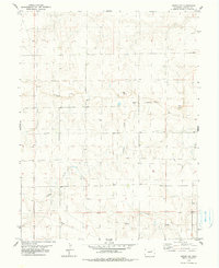
1979 Map of Arriba NW
USGS Topo · Published 1979About this map
Arikaree River and its tributary systems define this corner of Lincoln County during the late 1970s. The landscape is characterized by intermittent watercourses like Currie Creek, Lickdab Creek, and Dugout Creek, which carve a network of drainages across the high plains. Human activity in this rural expanse is marked by infrastructure and resource extraction rather than dense settlement, evidenced by a prominent north-south Pipeline and a localized Landing Strip. Small-scale industrial sites, including several Gravel Pits, are situated near the riverbanks, suggesting the importance of local material for road building or regional construction during this era. Scattered wells across the quadrangle highlight the ongoing necessity of groundwater management for the agricultural and ranching operations that utilize these wide-open grasslands.
Find a feature on this map
9 named features on this map. Tap any name to fly to it.
Don’t see what you’re looking for? This feature index may not catch every label — zoom into the map to look around manually.
Map Details
Editions of this 1979 Arriba NW Map
2 editions found
Other maps of this area

1891 · Limon
USGS Topo · 1:125,000

1892 · Limon
USGS Topo · 1:125,000

1954 · Limon
USGS Topo · 1:250,000

1957 · Limon
USGS Topo · 1:250,000

1958 · Limon
USGS Topo · 1:250,000

1973 · Lusto Springs
USGS Topo · 1:24,000

1973 · Lindon SW
USGS Topo · 1:24,000

1973 · Shaw
USGS Topo · 1:24,000

1979 · Arriba
USGS Topo · 1:24,000

1979 · Genoa East
USGS Topo · 1:24,000