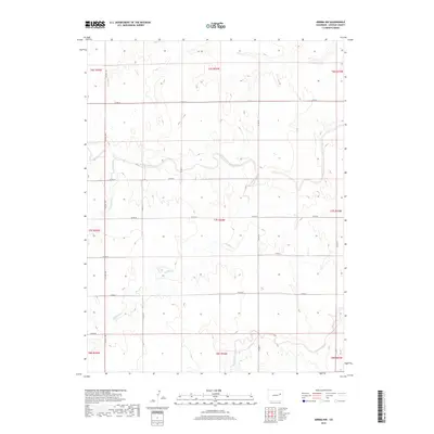
2019 Map of Arriba NW
USGS Topo · Published 2019About this map
The Arikaree River winds through this section of Lincoln County, defining a drainage system that includes Currie Creek and the meandering Lickdab Creek. This landscape is primarily shaped by the section lines of the Public Land Survey System, reflected in the orderly grid of local routes such as Co Rd 3x and Co Rd 3u. The terrain exhibits subtle elevation changes characteristic of the high plains, with the most significant relief found along the southern edge near Dugout Creek. This 2019 survey documents a sparsely populated rural area where the economy and movement are dictated by this rectilinear road network and the natural flow of the intermittent waterways that cross the townships of t7s r54w and its neighbors.
Find a feature on this map
20 named features on this map. Tap any name to fly to it.
Don’t see what you’re looking for? This feature index may not catch every label — zoom into the map to look around manually.
Map Details
Editions of this 2019 Arriba NW Map
This is the sole edition of this map. No revisions or reprints were ever made.
Other maps of this area

1891 · Limon
USGS Topo · 1:125,000

1892 · Limon
USGS Topo · 1:125,000

1954 · Limon
USGS Topo · 1:250,000

1957 · Limon
USGS Topo · 1:250,000

1958 · Limon
USGS Topo · 1:250,000

1973 · Lusto Springs
USGS Topo · 1:24,000

1973 · Lindon SW
USGS Topo · 1:24,000

1973 · Shaw
USGS Topo · 1:24,000

1979 · Arriba NW
USGS Topo · 1:24,000

1979 · Arriba
USGS Topo · 1:24,000