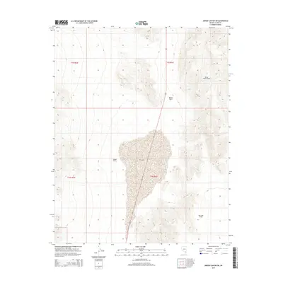
2015 Map of Arrow Canyon SW
USGS Topo · Published 2015About this map
Dry Lake dominates the central basin of this Clark County landscape, serving as a stark focal point between distinct desert valleys. This 2015 survey illustrates the characteristic drainage patterns of the Mojave Desert, where the elevation shifts from the floor of Hidden Valley toward the prominent heights of the Arrow Canyon Range in the northeast. The map provides a clear look at the geological boundaries of Dry Lake Valley, highlighting how the arid environment dictates the sparse network of tracks and modern infrastructure passing through these basins. It is an essential document for understanding the contemporary topography and public land divisions within the remote stretches of Southern Nevada.
Find a feature on this map
9 named features on this map. Tap any name to fly to it.
Don’t see what you’re looking for? This feature index may not catch every label — zoom into the map to look around manually.
Map Details
Editions of this 2015 Arrow Canyon SW Map
This is the sole edition of this map. No revisions or reprints were ever made.
Other maps of this area

1886 · Saint Thomas
USGS Topo · 1:250,000

1893 · Saint Thomas
USGS Topo · 1:250,000

1907 · Las Vegas
USGS Topo · 1:250,000

1908 · Las Vegas
USGS Topo · 1:250,000

1926 · Boulder Canyon
USGS Topo · 1:96,000

1945 · Sheep Range
USGS Topo · 1:125,000

1952 · Gass Peak
USGS Topo · 1:62,500

1952 · Dry Lake
USGS Topo · 1:62,500

1954 · Las Vegas
USGS Topo · 1:250,000

1957 · Las Vegas
USGS Topo · 1:250,000