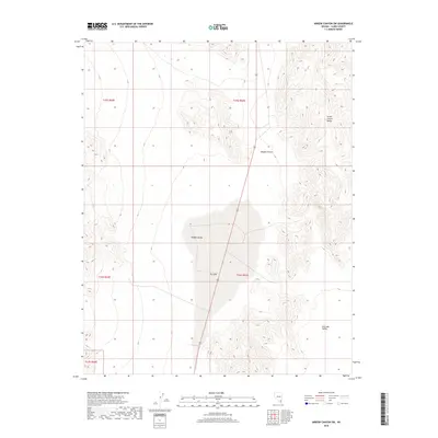
2018 Map of Arrow Canyon SW
USGS Topo · Published 2018About this map
Dry Lake sits at the center of this 2018 survey, marking a significant hydrologic feature in the arid Mojave Desert terrain. The map details the transition from the broad, flat expanse of Hidden Valley into the more complex topography of the Arrow Canyon Range along the eastern edge. This area of Clark County is defined by its dramatic elevation changes and large basins, typical of the basin and range geology. Transport through this stretch is dominated by a primary roadway cutting north-south through the center of the sheet, providing access between the high ground and the valley floor. To the southeast, the terrain descends toward Dry Lake Valley, highlighting the characteristic drainage patterns of the region's intermittent water systems.
Find a feature on this map
10 named features on this map. Tap any name to fly to it.
Don’t see what you’re looking for? This feature index may not catch every label — zoom into the map to look around manually.
Map Details
Editions of this 2018 Arrow Canyon SW Map
This is the sole edition of this map. No revisions or reprints were ever made.
Other maps of this area

1886 · Saint Thomas
USGS Topo · 1:250,000

1893 · Saint Thomas
USGS Topo · 1:250,000

1907 · Las Vegas
USGS Topo · 1:250,000

1908 · Las Vegas
USGS Topo · 1:250,000

1926 · Boulder Canyon
USGS Topo · 1:96,000

1945 · Sheep Range
USGS Topo · 1:125,000

1952 · Gass Peak
USGS Topo · 1:62,500

1952 · Dry Lake
USGS Topo · 1:62,500

1954 · Las Vegas
USGS Topo · 1:250,000

1957 · Las Vegas
USGS Topo · 1:250,000