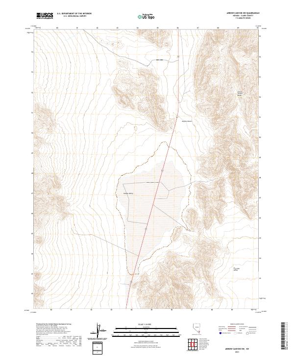
2021 Map of Arrow Canyon SW
USGS Topo · Published 2021About this map
Arrow Canyon Range dominates the eastern boundary of this landscape, its steep contours rising sharply above the arid basins of the Mojave Desert. The central portion of the sheet is defined by the broad, low-lying expanse of Hidden Valley, a distinct topographical depression that contrasts with the surrounding elevated terrain. This area represents a classic basin-and-range formation in Clark County, where dramatic elevation changes dictate the flow of water and the placement of transportation routes. To the southeast, the terrain opens into Dry Lake Valley, while the north-south corridor of Route 93 serves as the primary modern thoroughfare through this sparsely populated desert region. The map preserves the township and range survey lines, such as t16s r63e, which underpin the land division and resource management of the Nevada interior.
Find a feature on this map
10 named features on this map. Tap any name to fly to it.
Don’t see what you’re looking for? This feature index may not catch every label — zoom into the map to look around manually.
Map Details
Editions of this 2021 Arrow Canyon SW Map
This is the sole edition of this map. No revisions or reprints were ever made.
Other maps of this area

1886 · Saint Thomas
USGS Topo · 1:250,000

1893 · Saint Thomas
USGS Topo · 1:250,000

1907 · Las Vegas
USGS Topo · 1:250,000

1908 · Las Vegas
USGS Topo · 1:250,000

1926 · Boulder Canyon
USGS Topo · 1:96,000

1945 · Sheep Range
USGS Topo · 1:125,000

1952 · Gass Peak
USGS Topo · 1:62,500

1952 · Dry Lake
USGS Topo · 1:62,500

1954 · Las Vegas
USGS Topo · 1:250,000

1957 · Las Vegas
USGS Topo · 1:250,000