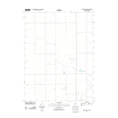
2011 Map of Arrowhead Lake
USGS Topo · Published 2011About this map
Indian Creek winds through this section of Dundy County, feeding into the waters of Arrowhead Lake. This 2011 survey of the High Plains landscape captures the area's transition into a managed water resource, marked by the presence of the Arrow Head Dam. The terrain is defined by a sparse, grid-like network of rural roads, including 339 Ave, which serves the agricultural parcels of this quiet corner of Nebraska. The map illustrates the fundamental relationship between the seasonal flow of the creek and the artificial reservoir that supports the local environment.
Find a feature on this map
4 named features on this map. Tap any name to fly to it.
Don’t see what you’re looking for? This feature index may not catch every label — zoom into the map to look around manually.
Map Details
Editions of this 2011 Arrowhead Lake Map
This is the sole edition of this map. No revisions or reprints were ever made.
Other maps of this area

1954 · McCook
USGS Topo · 1:250,000

1957 · McCook
USGS Topo · 1:250,000

1958 · McCook
USGS Topo · 1:250,000
1961 · Parks
USGS Topo · 1:24,000

1961 · Benkelman
USGS Topo · 1:24,000
1962 · Max
USGS Topo · 1:24,000

1973 · Champion SW
USGS Topo · 1:24,000

1973 · Ough
USGS Topo · 1:24,000

1973 · Wauneta SW
USGS Topo · 1:24,000
1973 · Benkelman NW
USGS Topo · 1:24,000