
1973 Map of Champion SW
USGS Topo · Published 1977About this map
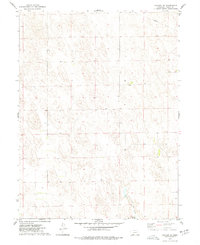
Chase and Dundy County borders define the mid-portion of this 1970s topographic study, where the High Plains landscape is marked by a distinct pattern of land use and natural terrain. Old Baldy rises as a prominent landmark in the western section, overlooking a topography defined by complex contouring and numerous windmills and irrigation sources labeled simply as Well. The map provides a precise record of the rural infrastructure during this era, capturing the isolated placement of Hiawatha Cem in the northeast. This sparsely settled region shows a transition in land management across the county line, visible through the network of section lines and improved roads that connect these high-desert ranchlands and agricultural plots.
Find a feature on this map
4 named features on this map. Tap any name to fly to it.
Don’t see what you’re looking for? This feature index may not catch every label — zoom into the map to look around manually.
Map Details
Editions of this 1973 Champion SW Map
This is the sole edition of this map. No revisions or reprints were ever made.
Other maps of this area

1954 · McCook
USGS Topo · 1:250,000

1957 · McCook
USGS Topo · 1:250,000

1958 · McCook
USGS Topo · 1:250,000

1973 · Champion
USGS Topo · 1:24,000
1973 · Haigler NE
USGS Topo · 1:24,000

1973 · Enders
USGS Topo · 1:24,000

1973 · Reservoir Lake SE
USGS Topo · 1:24,000

1973 · Ough
USGS Topo · 1:24,000
1973 · Benkelman NW
USGS Topo · 1:24,000
1973 · Reservoir Lake
USGS Topo · 1:24,000