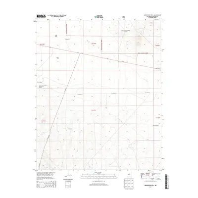
2013 Map of Arrowhead Well
USGS Topo · Published 2013About this map
The National Radio Astronomy Observatory VLA Telescope dominates the western edge of this Socorro County landscape, reflecting the high-altitude scientific importance of this remote basin. The topography transitions from the low-lying Sand Hills and White Lake in the north to the rising elevations of the Cibola National Forest in the south and east. A network of high-desert infrastructure is evident, with State Route 52 and Us-60 providing primary access, while the original alignment of Old Highway 60 remains visible on the terrain. Water management for ranching and forest use is a central theme, highlighted by scattered features like Arrowhead Well, Broke Tank, and Durfee Tank. To the southeast, the terrain becomes more complex as the land drops into Durfee Canyon, providing a stark contrast to the open flats used by the observatory's radio array.
Find a feature on this map
20 named features on this map. Tap any name to fly to it.
Don’t see what you’re looking for? This feature index may not catch every label — zoom into the map to look around manually.
Map Details
Editions of this 2013 Arrowhead Well Map
This is the sole edition of this map. No revisions or reprints were ever made.
Other maps of this area

1954 · Tularosa
USGS Topo · 1:250,000

1954 · Socorro
USGS Topo · 1:250,000

1958 · Socorro
USGS Topo · 1:250,000

1958 · Tularosa
USGS Topo · 1:250,000

1962 · Socorro
USGS Topo · 1:250,000

1964 · Arrowhead Well
USGS Topo · 1:24,000

1964 · Monica Saddle
USGS Topo · 1:24,000

1964 · Tres Montosas
USGS Topo · 1:24,000

1964 · Gallinas Peak
USGS Topo · 1:24,000

1964 · Lion Mountain
USGS Topo · 1:24,000