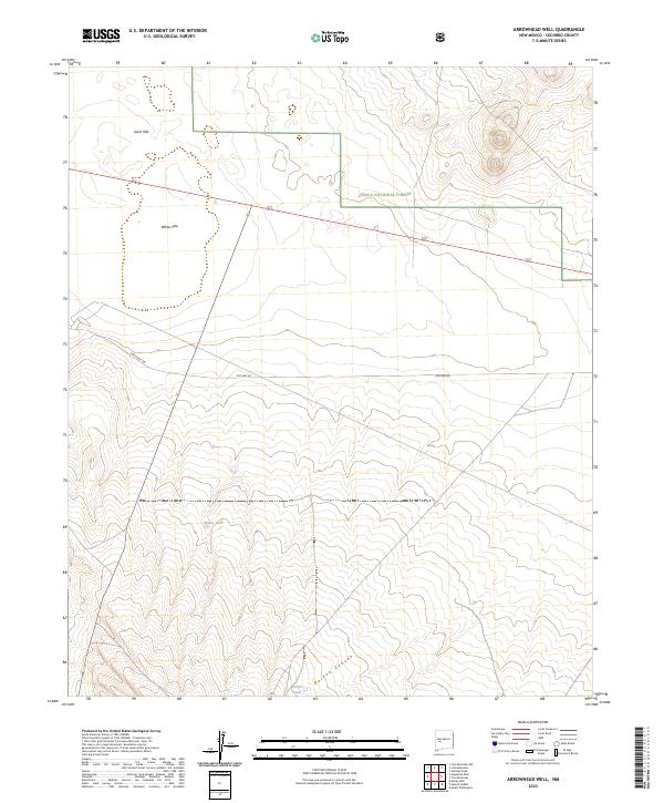
2023 Map of Arrowhead Well
USGS Topo · Published 2023About this map
Cibola National Forest encompasses the northern reaches of this high-desert landscape in Socorro County, where the terrain shifts from the prominent Sand Hills down toward the drainage of Durfee Canyon. The map reveals a land defined by water scarcity and historical transit routes. Isolated water sources such as White Lake, Broke Tank, and Durfee Tank serve as the primary landmarks in an otherwise open range. These tanks, vital for ranching and wildlife in the arid Southwest, are positioned alongside clear evidence of shifting transportation patterns. The alignment of Old Hwy 60 and State Hwy 166 demonstrates how modern infrastructure follows established corridors through the basin, providing a detailed record of the township and range divisions within this part of New Mexico.
Find a feature on this map
14 named features on this map. Tap any name to fly to it.
Don’t see what you’re looking for? This feature index may not catch every label — zoom into the map to look around manually.
Map Details
Editions of this 2023 Arrowhead Well Map
This is the sole edition of this map. No revisions or reprints were ever made.
Other maps of this area

1954 · Tularosa
USGS Topo · 1:250,000

1954 · Socorro
USGS Topo · 1:250,000

1958 · Socorro
USGS Topo · 1:250,000

1958 · Tularosa
USGS Topo · 1:250,000

1962 · Socorro
USGS Topo · 1:250,000

1964 · Arrowhead Well
USGS Topo · 1:24,000

1964 · Monica Saddle
USGS Topo · 1:24,000

1964 · Tres Montosas
USGS Topo · 1:24,000

1964 · Gallinas Peak
USGS Topo · 1:24,000

1964 · Lion Mountain
USGS Topo · 1:24,000