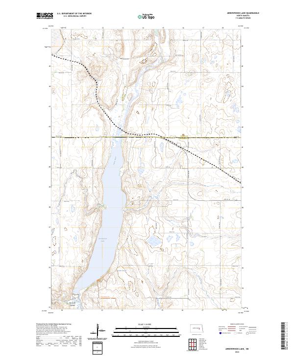
2024 Map of Arrowwood Lake
USGS Topo · Published 2024About this map
Arrowwood Lake and the winding James River anchor this central North Dakota landscape, where the prairie meets a vast network of managed wetlands and waterfowl habitats. The Arrowwood National Wildlife Refuge dominates the central corridor, preserving the natural transition from open water to shoreline environments like Warbler Woodland. This modern survey illustrates the enduring intersection of conservation and the historic land grid, featuring sections of the Foster County Waterfowl Production Area and the Stutsman County Waterfowl Production Area across the county line. Cultural traces remain in the road network, including the path of the Fort Totten Trl and family-named landmarks like Bennetts Coulee and Dollar Slough. The terrain is characterized by numerous small potholes and basins, typical of the glacial pothole region, drained by seasonal flows such as Stony Brook.
Find a feature on this map
25 named features on this map. Tap any name to fly to it.
Don’t see what you’re looking for? This feature index may not catch every label — zoom into the map to look around manually.
Map Details
Editions of this 2024 Arrowwood Lake Map
This is the sole edition of this map. No revisions or reprints were ever made.
Other maps of this area

1900 · Pingree
USGS Topo · 1:125,000

1900 · Pingree
USGS Topo · 1:62,500

1951 · Bordulac NE
USGS Topo · 1:24,000

1951 · Arrowwood Lake
USGS Topo · 1:24,000

1951 · Kensal
USGS Topo · 1:24,000

1951 · Kensal NW
USGS Topo · 1:24,000

1951 · Pingree
USGS Topo · 1:24,000

1951 · Bordulac SW
USGS Topo · 1:24,000
1951 · Bordulac
USGS Topo · 1:24,000

1952 · Jim Lake
USGS Topo · 1:24,000