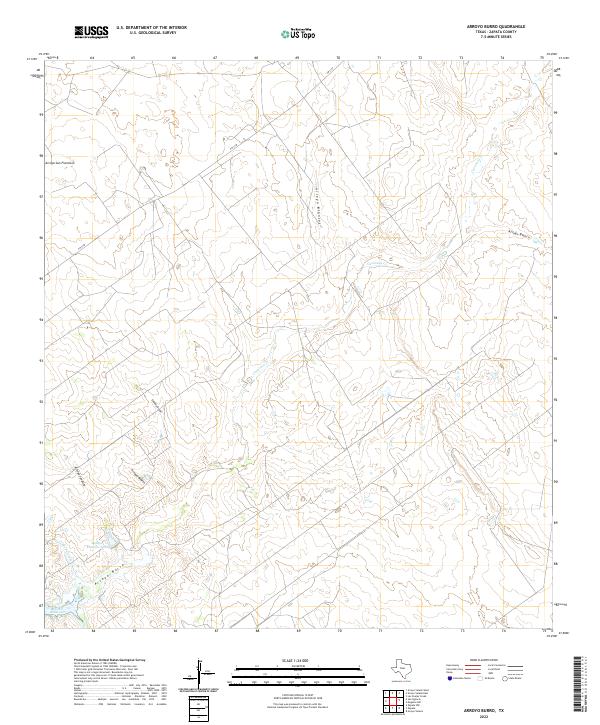
2022 Map of Arroyo Burro
USGS Topo · Published 2022About this map
Falcon Reservoir reaches into the southwest corner of this South Texas landscape, where the ephemeral drainages of Zapata County carve a complex network of arroyos through the brush country. The eponymous Arroyo Burro dominates the southern drainage pattern alongside Las Palomas Cr, while the northern reaches are defined by Arroyo San Francisco and Arroyo Blancas. This modern survey reveals a sparsely populated ranching environment where water management is critical, evidenced by landmarks like the Refugio Ramirez Tank. Beyond the lone corridor of FM 3169, the terrain is marked by traditional place names such as Cañada Rosias and Arroyo Javelina, reflecting the enduring geography of the Rio Grande Valley hinterlands.
Find a feature on this map
12 named features on this map. Tap any name to fly to it.
Don’t see what you’re looking for? This feature index may not catch every label — zoom into the map to look around manually.
Map Details
Editions of this 2022 Arroyo Burro Map
This is the sole edition of this map. No revisions or reprints were ever made.
Other maps of this area

1940 · Mogotes Hill
USGS Topo · 1:62,500

1942 · San Ygnacio
USGS Topo · 1:62,500

1949 · Mc Allen
USGS Topo · 1:250,000

1954 · McAllen
USGS Topo · 1:250,000

1956 · Mogotes Hill
USGS Topo · 1:62,500

1956 · Zapata
USGS Topo · 1:62,500

1956 · Arroyo Clareno
USGS Topo · 1:62,500

1956 · Laredo
USGS Topo · 1:250,000

1957 · Mc Allen
USGS Topo · 1:250,000

1962 · McAllen
USGS Topo · 1:250,000