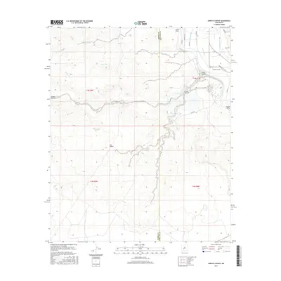
2017 Map of Arroyo Cuervo
USGS Topo · Published 2017About this map
The Rio Grande corridor defines the eastern edge of this landscape, supporting a complex irrigation network within the Rincon Valley. This system of managed water is evidenced by features such as the Garfield Canal, Garfield Drain, and several watercourses like the Garfield Lateral and Palmer Lateral. These features highlight the transition from the fertile river bottomlands to the arid, high-relief terrain of the west, where drainage is dominated by ephemeral washes like Arroyo Montoya and Arroyo Jaralosa.
Find a feature on this map
24 named features on this map. Tap any name to fly to it.
Don’t see what you’re looking for? This feature index may not catch every label — zoom into the map to look around manually.
Map Details
Editions of this 2017 Arroyo Cuervo Map
This is the sole edition of this map. No revisions or reprints were ever made.
Other maps of this area

1955 · Las Cruces
USGS Topo · 1:250,000

1958 · Las Cruces
USGS Topo · 1:250,000

1958 · Arroyo Cuervo
USGS Topo · 1:24,000

1959 · Hatch
USGS Topo · 1:24,000
1959 · Souse Springs
USGS Topo · 1:24,000

1959 · Upham
USGS Topo · 1:62,500

1961 · Nutt
USGS Topo · 1:62,500

1961 · Clark Spring Canyon
USGS Topo · 1:24,000

1961 · Garfield
USGS Topo · 1:24,000

1982 · Hatch
USGS Topo · 1:100,000