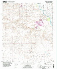
1996 Map of Arroyo Cuervo
USGS Topo · Published 2002About this map
The Rio Grande corridor defines this landscape where the Rincon Valley meets the arid uplands of the Uvas Valley. Irrigation infrastructure is prominent along the river, including the Garfield Canal and Garfield Lateral, which supported the agricultural development of the region. Local history is reflected in small, scattered features such as La Capilla de Don Silverio, a rural Cem, and several Ruins that hint at former homesteads or ranching outposts.
Find a feature on this map
17 named features on this map. Tap any name to fly to it.
Don’t see what you’re looking for? This feature index may not catch every label — zoom into the map to look around manually.
Map Details
Editions of this 1996 Arroyo Cuervo Map
This is the sole edition of this map. No revisions or reprints were ever made.
Other maps of this area

1955 · Las Cruces
USGS Topo · 1:250,000

1958 · Las Cruces
USGS Topo · 1:250,000

1958 · Arroyo Cuervo
USGS Topo · 1:24,000

1959 · Hatch
USGS Topo · 1:24,000
1959 · Souse Springs
USGS Topo · 1:24,000

1959 · Upham
USGS Topo · 1:62,500

1961 · Nutt
USGS Topo · 1:62,500

1961 · Clark Spring Canyon
USGS Topo · 1:24,000

1961 · Garfield
USGS Topo · 1:24,000

1982 · Hatch
USGS Topo · 1:100,000