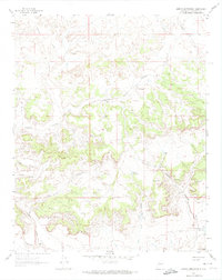
1961 Map of Arroyo Empedrado
USGS Topo · Published 1964About this map
Mesa San Luis dominates this high-desert landscape in Sandoval County, carved by an intricate network of seasonal drainages. The topography is defined by the significant passage of Torreon Wash and Arroyo Empedrado, which channel runoff through the arid terrain. Natural water sources and catchment areas were vital for land use in this era, as evidenced by the Laguna de la Leña and the Cabezon Community Reservoir in the southeast.
Find a feature on this map
14 named features on this map. Tap any name to fly to it.
Don’t see what you’re looking for? This feature index may not catch every label — zoom into the map to look around manually.
Map Details
Editions of this 1961 Arroyo Empedrado Map
2 editions found
Other maps of this area

1883 · Mt. Taylor
USGS Topo · 1:250,000

1886 · Mt. Taylor
USGS Topo · 1:250,000

1892 · Mt. Taylor
USGS Topo · 1:250,000

1899 · Mt. Taylor
USGS Topo · 1:250,000

1958 · Albuquerque
USGS Topo · 1:250,000
1961 · Headcut Reservoir
USGS Topo · 1:24,000

1961 · Cerro Parido
USGS Topo · 1:24,000

1961 · Arroyo Empedrado
USGS Topo · 1:24,000
1961 · Canada Calladita
USGS Topo · 1:24,000
1961 · Tinian
USGS Topo · 1:24,000