
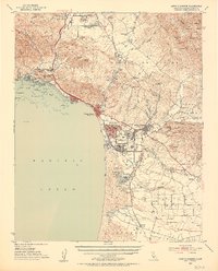
1952 Map of Arroyo Grande
USGS Topo · Published 1953About this map
Coastal dunes and agricultural valleys define this mid-century portrait of San Luis Obispo County. The Southern Pacific RR tracks parallel the Pacific shoreline, serving a string of communities from the seaside resort atmosphere of Pismo Beach and Shell Beach to the inland hub of Arroyo Grande. In the southern portion of the map, an intricate network of freshwater bodies including Black Lake, Jack Lake, and Oso Flaco Lake sits tucked behind the massive Sand Dunes of the Oceano coast.
Find a feature on this map
101 named features on this map. Tap any name to fly to it.
Don’t see what you’re looking for? This feature index may not catch every label — zoom into the map to look around manually.
Map Details
Editions of this 1952 Arroyo Grande Map
3 editions found
Other maps of this area

1897 · Port Harford
USGS Topo · 1:62,500

1897 · San Luis Obispo
USGS Topo · 1:62,500

1897 · Cayucos
USGS Topo · 1:62,500

1897 · Arroyo Grande
USGS Topo · 1:62,500

1900 · San Luis
USGS Topo · 1:125,000

1905 · Guadalupe
USGS Topo · 1:125,000

1905 · Lompoc
USGS Topo · 1:125,000

1922 · Pozo
USGS Topo · 1:62,500

1922 · Nipomo
USGS Topo · 1:62,500

1937 · Cayucos
USGS Topo · 1:62,500