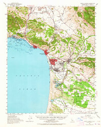
1952 Map of Arroyo Grande
USGS Topo · Published 1964About this map
Arroyo Grande and the central coast of San Luis Obispo County are captured here during a period of mid-century growth. The map illustrates the coastal development of Pismo Beach, Grover City, and Oceano, framed by the extensive Sand Dunes to the south. Along the Southern Pacific rail line, small sidings and settlements like Hadley, Callender, and Bromela mark the agricultural and industrial corridor.
Find a feature on this map
95 named features on this map. Tap any name to fly to it.
Don’t see what you’re looking for? This feature index may not catch every label — zoom into the map to look around manually.
Map Details
Editions of this 1952 Arroyo Grande Map
3 editions found

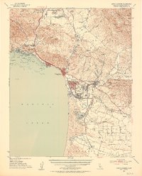
Other maps of this area

1897 · Port Harford
USGS Topo · 1:62,500

1897 · San Luis Obispo
USGS Topo · 1:62,500

1897 · Cayucos
USGS Topo · 1:62,500

1897 · Arroyo Grande
USGS Topo · 1:62,500

1900 · San Luis
USGS Topo · 1:125,000

1905 · Guadalupe
USGS Topo · 1:125,000

1905 · Lompoc
USGS Topo · 1:125,000

1922 · Pozo
USGS Topo · 1:62,500

1922 · Nipomo
USGS Topo · 1:62,500

1937 · Cayucos
USGS Topo · 1:62,500