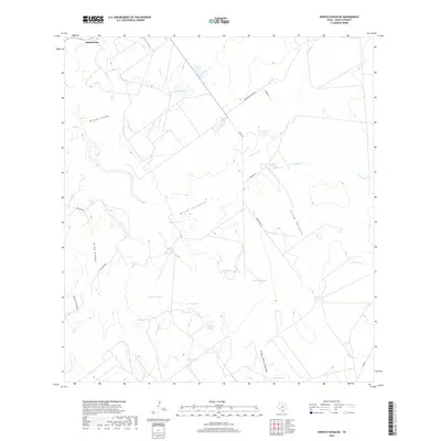
2019 Map of Arroyo Huisache
USGS Topo · Published 2019About this map
Bustamante sits at the northern edge of this Zapata County landscape, a region defined by a sophisticated network of water management features and seasonal arroyos. The terrain is marked by numerous stock tanks—such as Lobitas Tank, Volpe Tank, and Beulah Tank—which provide critical water points across the brushland. These tanks are connected by a complex drainage system including the Arroyo Huisache, Arroyo Carizales, and Arroyo Palomas. The presence of these named reservoirs and creeks suggests a ranching economy where water security dictates the layout of the land. Roadways like Dorace Goodman Rd and FM 2687 cut through the South Texas scrub, linking remote ranch headquarters and providing access to the various forks of Villa Cr and Adame Cr.
Find a feature on this map
29 named features on this map. Tap any name to fly to it.
Don’t see what you’re looking for? This feature index may not catch every label — zoom into the map to look around manually.
Map Details
Editions of this 2019 Arroyo Huisache Map
This is the sole edition of this map. No revisions or reprints were ever made.
Other maps of this area

1938 · Cuevitas
USGS Topo · 1:62,500

1939 · Randado
USGS Topo · 1:62,500

1940 · Randado
USGS Topo · 1:62,500

1940 · Mogotes Hill
USGS Topo · 1:62,500

1949 · Mc Allen
USGS Topo · 1:250,000

1954 · McAllen
USGS Topo · 1:250,000

1956 · Mogotes Hill
USGS Topo · 1:62,500

1956 · Arroyo Clareno
USGS Topo · 1:62,500

1956 · Laredo
USGS Topo · 1:250,000

1957 · Mc Allen
USGS Topo · 1:250,000