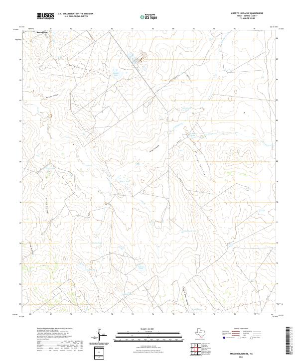
2022 Map of Arroyo Huisache
USGS Topo · Published 2022About this map
Bustamante serves as the primary focal point in this south Texas landscape, situated in the northwestern corner of the quadrangle near the Bustamante Cem. The area is defined by a sophisticated network of water management features essential for ranching and agriculture in Zapata County. Numerous livestock tanks, such as Lobitas Tank, Burras Tank, and Beulah Tank, are strategically placed throughout the terrain to catch runoff from seasonal drainages like Arroyo Salado and Villa Cr. The land is scored by several significant arroyos, including Arroyo Huisache and Arroyo Carrizales, which indicate a semi-arid environment where water flow is periodic but intense enough to carve distinct topographical features. Local infrastructure is represented by a series of named roads like Dorace Goodman Rd and Hayes Rd, which connect various remote tanks and ranching sites across the brushland.
Find a feature on this map
30 named features on this map. Tap any name to fly to it.
Don’t see what you’re looking for? This feature index may not catch every label — zoom into the map to look around manually.
Map Details
Editions of this 2022 Arroyo Huisache Map
This is the sole edition of this map. No revisions or reprints were ever made.
Other maps of this area

1938 · Cuevitas
USGS Topo · 1:62,500

1939 · Randado
USGS Topo · 1:62,500

1940 · Randado
USGS Topo · 1:62,500

1940 · Mogotes Hill
USGS Topo · 1:62,500

1949 · Mc Allen
USGS Topo · 1:250,000

1954 · McAllen
USGS Topo · 1:250,000

1956 · Mogotes Hill
USGS Topo · 1:62,500

1956 · Arroyo Clareno
USGS Topo · 1:62,500

1956 · Laredo
USGS Topo · 1:250,000

1957 · Mc Allen
USGS Topo · 1:250,000