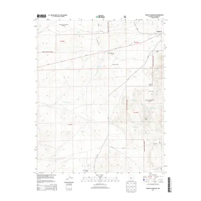
2013 Map of Arroyo Landavaso
USGS Topo · Published 2013About this map
Magdalena serves as the primary settlement in this high-desert region of Socorro County, where the landscape is defined by the expansive Cibola National Forest and a complex network of seasonal drainage systems. The importance of water management in this arid environment is evident through the numerous numbered cattle tanks and catchments, such as Earth Tank Number One and Landavaso Reservoir, which support local ranching operations. Significant geological features include the prominent Cerro Pelon and the deep cuts of Agua Frio Canyon. Transportation and infrastructure are concentrated around Us-60, which bisects the northern half of the map near the Rancho Magdalena Airport. The area’s rangeland history is preserved through labels for the Woodbury Ranch and several named springs, including Wet Weather Spring and Texas Spring, highlighting the essential points of reliability for inhabitants in the high desert.
Find a feature on this map
39 named features on this map. Tap any name to fly to it.
Don’t see what you’re looking for? This feature index may not catch every label — zoom into the map to look around manually.
Map Details
Editions of this 2013 Arroyo Landavaso Map
This is the sole edition of this map. No revisions or reprints were ever made.
Other maps of this area

1954 · Tularosa
USGS Topo · 1:250,000

1954 · Socorro
USGS Topo · 1:250,000

1958 · Socorro
USGS Topo · 1:250,000

1958 · Tularosa
USGS Topo · 1:250,000

1959 · Magdalena
USGS Topo · 1:62,500

1962 · Socorro
USGS Topo · 1:250,000

1963 · Arroyo Landavaso
USGS Topo · 1:24,000

1964 · Silver Hill
USGS Topo · 1:24,000

1964 · Tres Montosas
USGS Topo · 1:24,000

1964 · Gallinas Peak
USGS Topo · 1:24,000