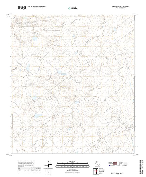
2022 Map of Arroyo Salado East
USGS Topo · Published 2022About this map
Arroyo Salado snakes through this ranchland landscape in Zapata County, defining the drainage patterns of a region characterized by ephemeral waterways and low-lying topography. The map illustrates a network of unimproved roads and fences typical of South Texas cattle country, where water management is central to the land's utility. Significant water features such as Jesse McNeel Lake Number 4 and the winding course of Cavasara Cr serve as vital landmarks in this sparse terrain. Transportation through the area is anchored by FM 3169 and Ranch Rd 3169, which provide the primary access to the isolated ranch tracts. This survey offers a precise look at the rural infrastructure of the early 2020s, documenting the specific locations of stock tanks and named watercourses that have historically dictated the patterns of settlement and agriculture in this semi-arid environment.
Find a feature on this map
5 named features on this map. Tap any name to fly to it.
Don’t see what you’re looking for? This feature index may not catch every label — zoom into the map to look around manually.
Map Details
Editions of this 2022 Arroyo Salado East Map
This is the sole edition of this map. No revisions or reprints were ever made.
Other maps of this area

1933 · Becerra Creek
USGS Topo · 1:62,500

1940 · Aguilares
USGS Topo · 1:62,500

1940 · Mogotes Hill
USGS Topo · 1:62,500

1942 · San Ygnacio
USGS Topo · 1:62,500

1956 · Mogotes Hill
USGS Topo · 1:62,500

1956 · Laredo
USGS Topo · 1:250,000
1979 · San Ygnacio
USGS Topo · 1:24,000

1979 · O'Keefe Lake
USGS Topo · 1:24,000
1980 · Mogotes Hill
USGS Topo · 1:24,000
1980 · Agua Azul Creek West
USGS Topo · 1:24,000