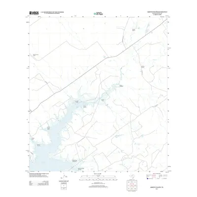
2012 Map of Arroyo Veleno
USGS Topo · Published 2012About this map
Falcon Reservoir dominates the southwestern quadrant of this Zapata County landscape, where the rising waters of the Rio Grande meet a dense network of intermittent drainages. The area is defined by a system of arroyos that feed into the reservoir, including Arroyo Costa Rica, Arroyo Indio, and the prominent Arroyo Veleño. This hydraulic pattern reveals a terrain shaped by seasonal water flow, where named tanks like Hondo Tank and Maestro Tank provide critical water storage points across the ranchlands. North of the reservoir, the Zapata County Airport serves as a modern hub connected by Airport Rd, while the surrounding land is crisscrossed by ranching routes such as Jennings Ranch Rd and San Jose Rd. These roads and water features, including Salómoneno Cr and Villa Cr, delineate property boundaries and livestock access in a region defined by its proximity to the international border.
Find a feature on this map
29 named features on this map. Tap any name to fly to it.
Don’t see what you’re looking for? This feature index may not catch every label — zoom into the map to look around manually.
Map Details
Editions of this 2012 Arroyo Veleno Map
This is the sole edition of this map. No revisions or reprints were ever made.
Other maps of this area

1940 · Mogotes Hill
USGS Topo · 1:62,500

1942 · San Ygnacio
USGS Topo · 1:62,500

1949 · Mc Allen
USGS Topo · 1:250,000

1954 · McAllen
USGS Topo · 1:250,000

1956 · Mogotes Hill
USGS Topo · 1:62,500

1956 · Zapata
USGS Topo · 1:62,500

1956 · Arroyo Clareno
USGS Topo · 1:62,500

1956 · Laredo
USGS Topo · 1:250,000

1957 · Mc Allen
USGS Topo · 1:250,000

1962 · McAllen
USGS Topo · 1:250,000