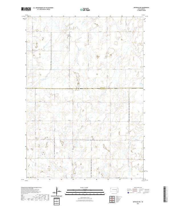
2021 Map of Artesian NW
USGS Topo · Published 2021About this map
The Beadle Co and Sanborn Co line divides this prairie landscape, where a precise grid of section lines and gravel roads facilitates the region's agricultural life. This 2021 survey shows a terrain marked by the winding courses of the S Fork Pearl Cr and Stony Run, which create the only irregular breaks in the geometric layout of townships like t109n r60w and t108n r59w. For the local historian or genealogist, the map preserves the location of critical community landmarks such as Immanuel Lutheran Church Cem in the north and Saint Anthony's Cem further south. These sites, often the only remaining physical links to the early families of the Dakota plains, stand amidst a network of county routes including Co Hwy 24 and Co Hwy 25.
Find a feature on this map
28 named features on this map. Tap any name to fly to it.
Don’t see what you’re looking for? This feature index may not catch every label — zoom into the map to look around manually.
Map Details
Editions of this 2021 Artesian NW Map
This is the sole edition of this map. No revisions or reprints were ever made.
Other maps of this area

1898 · Huron
USGS Topo · 1:125,000

1899 · De Smet
USGS Topo · 1:125,000

1953 · Huron
USGS Topo · 1:250,000

1953 · Watertown
USGS Topo · 1:250,000

1954 · Huron
USGS Topo · 1:250,000

1957 · Forestburg NE
USGS Topo · 1:24,000
1957 · Forestburg
USGS Topo · 1:24,000

1957 · Cavour
USGS Topo · 1:24,000

1958 · Watertown
USGS Topo · 1:250,000

1971 · Iroquois
USGS Topo · 1:24,000