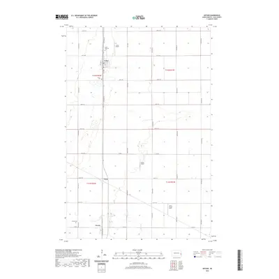
2020 Map of Arthur
USGS Topo · Published 2020About this map
Arthur and Amenia anchor this section of the Red River Valley, where the grid of Cass County roads meets the winding path of the Rush River. The landscape is defined by its agrarian order, with the river providing a natural break in the rectilinear township and range system. In the northern portion of the map, the town of Arthur is a center of local activity, home to the Arthur Airport and the Arthur Cemetery, as well as the Good Samaritan Cemetery. Further south, the settlement of Amenia sits near its namesake Amenia Cemetery and the smaller locality of Vance. This 2020 record of the region captures the modern distribution of small private airstrips, including Nelson Airport and Smith Private Airport, which suggest the continued importance of aerial accessibility for the surrounding farmland.
Find a feature on this map
35 named features on this map. Tap any name to fly to it.
Don’t see what you’re looking for? This feature index may not catch every label — zoom into the map to look around manually.
Map Details
Editions of this 2020 Arthur Map
This is the sole edition of this map. No revisions or reprints were ever made.
Other maps of this area
1895 · Casselton
USGS Topo · 1:125,000
1897 · Casselton
USGS Topo · 1:125,000

1952 · Grand Forks
USGS Topo · 1:250,000

1953 · Fargo
USGS Topo · 1:250,000

1956 · Fargo
USGS Topo · 1:250,000

1956 · Grand Forks
USGS Topo · 1:250,000
1961 · Casselton
USGS Topo · 1:24,000
1961 · Mapleton
USGS Topo · 1:24,000
1966 · Grand Forks
USGS Topo · 1:250,000
1966 · Arthur SE
USGS Topo · 1:24,000