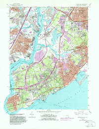
1966 Map of Arthur Kill
USGS Topo · Published 1988About this map
Arthur Kill serves as the industrial and tidal artery separating Staten Island from the New Jersey mainland, framing a landscape defined by heavy transit and historic institutional footprints. On the New York side, large-scale land use is evident at the Willowbrook State School and the extensive marshlands around Fresh Kills, which contrast with the dense residential grids of Tottenville and Great Kills. The map captures the significant concentration of memorial sites in the Richmond interior, including Baron Hirsch Cemetery and Mount Richmond Cemetery, reflecting the borough's role in the region's funerary history.
Find a feature on this map
116 named features on this map. Tap any name to fly to it.
Don’t see what you’re looking for? This feature index may not catch every label — zoom into the map to look around manually.
Map Details
Editions of this 1966 Arthur Kill Map
4 editions found
Other maps of this area

1888 · Plainfield
USGS Topo · 1:62,500

1888 · New Brunswick
USGS Topo · 1:62,500

1888 · Sandy Hook
USGS Topo · 1:62,500

1893 · New Brunswick
USGS Topo · 1:62,500

1893 · Plainfield
USGS Topo · 1:62,500

1893 · Sandy Hook
USGS Topo · 1:62,500

1898 · Plainfield
USGS Topo · 1:62,500

1898 · Staten Island
USGS Topo · 1:62,500

1900 · Passaic
USGS Topo · 1:125,000

1900 · Staten Island
USGS Topo · 1:62,500