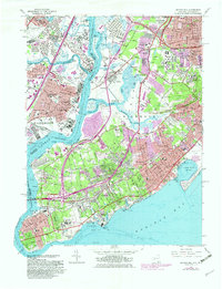
1966 Map of Arthur Kill
USGS Topo · Published 1982About this map
Staten Island’s western shoreline and the industrial corridor of northeastern New Jersey meet across the Arthur Kill. This mid-century survey captures a landscape in transition, where established South Shore communities like Tottenville and Princes Bay remain distinct from the intensifying development to the north. Extensive wetlands and tidal flats surround the Fresh Kills and Richmond Creek, marking the natural geography before later expansion.
Find a feature on this map
76 named features on this map. Tap any name to fly to it.
Don’t see what you’re looking for? This feature index may not catch every label — zoom into the map to look around manually.
Map Details
Editions of this 1966 Arthur Kill Map
4 editions found
Other maps of this area

1888 · Plainfield
USGS Topo · 1:62,500

1888 · New Brunswick
USGS Topo · 1:62,500

1888 · Sandy Hook
USGS Topo · 1:62,500

1893 · New Brunswick
USGS Topo · 1:62,500

1893 · Plainfield
USGS Topo · 1:62,500

1893 · Sandy Hook
USGS Topo · 1:62,500

1898 · Plainfield
USGS Topo · 1:62,500

1898 · Staten Island
USGS Topo · 1:62,500

1900 · Passaic
USGS Topo · 1:125,000

1900 · Staten Island
USGS Topo · 1:62,500