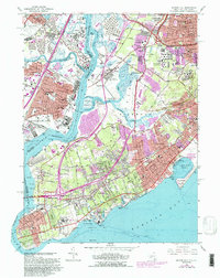
1966 Map of Arthur Kill
USGS Topo · Published 1988About this map
The industrial corridor of the Arthur Kill separates the bustling refinery towns of New Jersey from the suburban expansion of Staten Island in the mid-1960s. On the New York side, the landscape is defined by massive institutions and public spaces like the Willowbrook State School and La Tourette Park, alongside sprawling burial grounds such as Baron Hirsch Cemetery and Ocean View Cemetery. The western shore of Richmond is a complex of waterways and marshlands, including Fresh Kills and Pralls Island, where the Department of Sanitation operated adjacent to historic settlements like Rossville and Chelsea.
Find a feature on this map
79 named features on this map. Tap any name to fly to it.
Don’t see what you’re looking for? This feature index may not catch every label — zoom into the map to look around manually.
Map Details
Editions of this 1966 Arthur Kill Map
4 editions found
Other maps of this area

1888 · Plainfield
USGS Topo · 1:62,500

1888 · New Brunswick
USGS Topo · 1:62,500

1888 · Sandy Hook
USGS Topo · 1:62,500

1893 · New Brunswick
USGS Topo · 1:62,500

1893 · Plainfield
USGS Topo · 1:62,500

1893 · Sandy Hook
USGS Topo · 1:62,500

1898 · Plainfield
USGS Topo · 1:62,500

1898 · Staten Island
USGS Topo · 1:62,500

1900 · Passaic
USGS Topo · 1:125,000

1900 · Staten Island
USGS Topo · 1:62,500