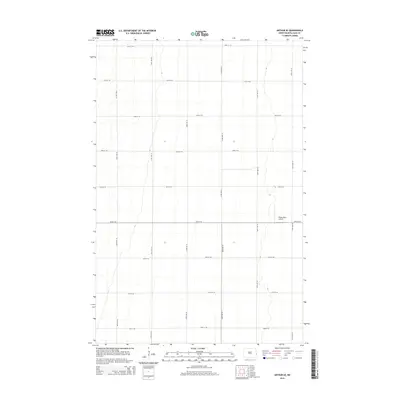
2014 Map of Arthur SE
USGS Topo · Published 2014About this map
The agricultural landscape of Berlin Township is defined by a rigid section-line grid of rural roads and expansive open fields. Located in the eastern portion of the state, this area maintains a strictly functional layout designed for large-scale farming operations. A notable break in the pattern of section lines is the Walkinshaw Airport, a small private landing strip situated in the eastern part of the quadrangle near 165th Ave SE. The terrain is exceptionally flat, typical of the Red River Valley region, with the road network including arteries like 20th St SE and 28th St SE providing the primary structure for the rural community. This survey serves as a clear record of modern land use in North Dakota's grain-producing heartland.
Find a feature on this map
16 named features on this map. Tap any name to fly to it.
Don’t see what you’re looking for? This feature index may not catch every label — zoom into the map to look around manually.
Map Details
Editions of this 2014 Arthur SE Map
This is the sole edition of this map. No revisions or reprints were ever made.
Other maps of this area

1895 · Fargo
USGS Topo · 1:125,000

1895 · Casselton
USGS Topo · 1:125,000

1897 · Fargo
USGS Topo · 1:125,000

1897 · Casselton
USGS Topo · 1:125,000

1952 · Grand Forks
USGS Topo · 1:250,000

1953 · Fargo
USGS Topo · 1:250,000

1956 · Fargo
USGS Topo · 1:250,000

1956 · Grand Forks
USGS Topo · 1:250,000

1959 · West Fargo
USGS Topo · 1:24,000

1961 · Casselton
USGS Topo · 1:24,000