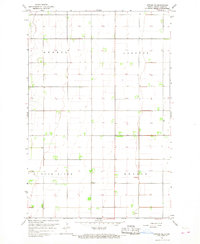
1966 Map of Arthur SE
USGS Topo · Published 1968About this map
Agricultural township boundaries in Cass County define the landscape of this mid-1960s survey, illustrating the systematic grid of the Red River Valley. The area is divided into the districts of Gunkel, Gardner, Rush River, and Berlin, reflecting the early administrative organization of North Dakota's farmland. A key landmark for local history is Herby Ch, located in the southern half of the map. The terrain is characterized by its remarkable flatness, with subtle drainage patterns and occasional farmstead windbreaks breaking the horizon. This survey captures the rural infrastructure before modern shifts in large-scale farming, documenting the precise location of section lines, section-line roads, and individual rural dwellings that supported the local wheat and beet economies of the era.
Find a feature on this map
5 named features on this map. Tap any name to fly to it.
Don’t see what you’re looking for? This feature index may not catch every label — zoom into the map to look around manually.
Map Details
Editions of this 1966 Arthur SE Map
This is the sole edition of this map. No revisions or reprints were ever made.
Other maps of this area

1895 · Fargo
USGS Topo · 1:125,000

1895 · Casselton
USGS Topo · 1:125,000

1897 · Fargo
USGS Topo · 1:125,000

1897 · Casselton
USGS Topo · 1:125,000

1952 · Grand Forks
USGS Topo · 1:250,000

1953 · Fargo
USGS Topo · 1:250,000

1956 · Fargo
USGS Topo · 1:250,000

1956 · Grand Forks
USGS Topo · 1:250,000

1959 · West Fargo
USGS Topo · 1:24,000

1961 · Casselton
USGS Topo · 1:24,000