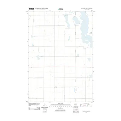
2010 Map of Artichoke Lake
USGS Topo · Published 2010About this map
Artichoke Lake dominates the eastern landscape of this Big Stone County region, its irregular shoreline creating a complex network of inlets and peninsulas. The terrain is defined by a grid-like agricultural road system and significant water bodies, including Long Lake at the northern edge. For those researching local family histories, the map preserves the locations of the Johnson Family Cemetery near the eastern shore and the Akron Cemetery further west. A secondary network of township roads like T-139 and T-155 branch off from primary routes such as County Hwy-10 and County Hwy-75, illustrating the enduring spatial organization of rural Minnesota farmlands in the early twenty-first century.
Find a feature on this map
19 named features on this map. Tap any name to fly to it.
Don’t see what you’re looking for? This feature index may not catch every label — zoom into the map to look around manually.
Map Details
Editions of this 2010 Artichoke Lake Map
This is the sole edition of this map. No revisions or reprints were ever made.
Other maps of this area

1953 · Ortonville
USGS Topo · 1:62,500

1953 · Bellingham
USGS Topo · 1:62,500

1953 · Milbank
USGS Topo · 1:250,000

1958 · Milbank
USGS Topo · 1:250,000

1958 · Correll
USGS Topo · 1:24,000

1958 · Appleton
USGS Topo · 1:24,000

1968 · Dry Wood Lake
USGS Topo · 1:24,000

1968 · Lake Oliver
USGS Topo · 1:24,000

1968 · Artichoke Lake NW
USGS Topo · 1:24,000

1968 · Artichoke Lake
USGS Topo · 1:24,000