
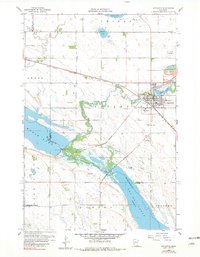
1958 Map of Appleton
USGS Topo · Published 1960About this map
The Pomme De Terre River winds through the heart of this landscape, joining the Minnesota River amidst a complex network of wetlands and reservoirs. The town of Appleton serves as the regional hub, characterized by its established street grid, the Municipal Hospital, and a Fairground located on the southern edge. The area's water management is central to its identity, featuring the Spillway 938 and Gaging Stations that monitor the flow between Marsh Lake and the vast Lac Qui Parle Lake.
Find a feature on this map
28 named features on this map. Tap any name to fly to it.
Don’t see what you’re looking for? This feature index may not catch every label — zoom into the map to look around manually.
Map Details
Editions of this 1958 Appleton Map
2 editions found
Other maps of this area

1953 · Milbank
USGS Topo · 1:250,000

1953 · Saint Cloud
USGS Topo · 1:250,000

1957 · Saint Cloud
USGS Topo · 1:250,000

1958 · Milbank
USGS Topo · 1:250,000

1958 · Saint Cloud
USGS Topo · 1:250,000

1958 · Cerro Gordo
USGS Topo · 1:24,000

1958 · Madison
USGS Topo · 1:24,000

1958 · Correll
USGS Topo · 1:24,000

1958 · Milan
USGS Topo · 1:24,000

1958 · Milan NW
USGS Topo · 1:24,000