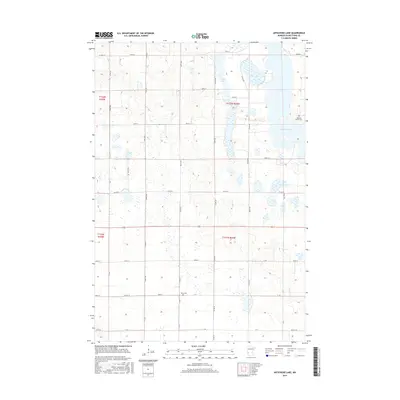
2016 Map of Artichoke Lake
USGS Topo · Published 2016About this map
Artichoke Lake and Long Lake dominate this prairie landscape in Big Stone County, defined by a rigid grid of agricultural roads and section lines. The terrain is characterized by numerous small depressions and wetlands typical of the glacial till plains, with the larger water bodies serving as the primary geographic anchors. For those researching local family history, the map identifies small, isolated burial sites including the Johnson Family Cem near the eastern shore of Artichoke Lake and the Akron Cem situated along 440th ST. This modern survey reflects the enduring rural character of the region, where transportation is dictated by numbered routes such as Co Hwy 14 and Co Rd 64. The settlement pattern is sparse, consisting of occasional farmsteads connected by a network of gravel and paved roads like 370th ST and Co Rd 14.
Find a feature on this map
21 named features on this map. Tap any name to fly to it.
Don’t see what you’re looking for? This feature index may not catch every label — zoom into the map to look around manually.
Map Details
Editions of this 2016 Artichoke Lake Map
This is the sole edition of this map. No revisions or reprints were ever made.
Other maps of this area

1953 · Ortonville
USGS Topo · 1:62,500

1953 · Bellingham
USGS Topo · 1:62,500

1953 · Milbank
USGS Topo · 1:250,000

1958 · Milbank
USGS Topo · 1:250,000

1958 · Correll
USGS Topo · 1:24,000

1958 · Appleton
USGS Topo · 1:24,000

1968 · Dry Wood Lake
USGS Topo · 1:24,000

1968 · Lake Oliver
USGS Topo · 1:24,000

1968 · Artichoke Lake NW
USGS Topo · 1:24,000

1968 · Artichoke Lake
USGS Topo · 1:24,000