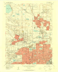
1957 Map of Arvada
USGS Topo · Published 1958About this map
Arvada and the burgeoning suburbs northwest of Denver are captured here during a period of rapid mid-century expansion. The landscape is a complex network of irrigation infrastructure, including the Farmers Highline Canal and Croke Canal, which supported the area's agricultural roots even as residential developments like Wheat Ridge, Westminster, and Edgewater began to fill the grid. The map reveals a dense concentration of social and religious institutions, from Regis College and Belleview College to numerous parochial schools such as St Peter and Pauls Sch. Notable landmarks include the historic Elitch Gardens amusement park, the massive Crown Hill Cemetery featuring the Tower of Memories, and industrial footprints like the Gravel Pits along Clear Creek. This era also shows the early impact of the Denver Boulder Turnpike on local transit patterns.
Find a feature on this map
128 named features on this map. Tap any name to fly to it.
Don’t see what you’re looking for? This feature index may not catch every label — zoom into the map to look around manually.
Map Details
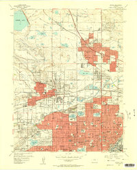
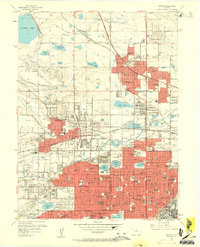
Editions of this 1957 Arvada Map
3 editions found
Other maps of this area

1890 · East Denver
USGS Topo · 1:125,000

1899 · West Denver
USGS Topo · 1:125,000

1935 · East Denver Nos. 3 and 4
USGS Topo · 1:48,000

1938 · Morrison
USGS Topo · 1:24,000

1938 · Derby
USGS Topo · 1:24,000

1939 · Golden
USGS Topo · 1:24,000

1940 · Englewood
USGS Topo · 1:31,680

1940 · Eastlake
USGS Topo · 1:31,680

1940 · Lafayette
USGS Topo · 1:31,680

1940 · Derby
USGS Topo · 1:31,680