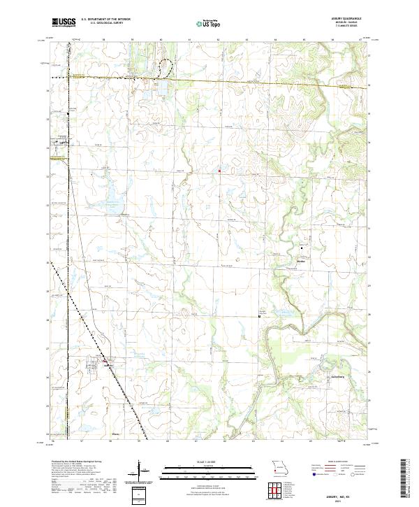
2021 Map of Asbury
USGS Topo · Published 2021About this map
Asbury and Galesburg anchor this corner of southwest Missouri, where the agricultural landscape meets the Kansas Missouri border. The terrain is defined by the winding paths of the Spring River and its North Fork, which create a network of bottomlands and small lakes like Browning West Lake and Asbury Farms Lake. The map reveals the persistence of early rural hubs, notably Medoc and Waco, each established near natural watercourses. Genealogists can trace local burials at the Georgia City Cem or the Medoc Cem, while the northern border is marked by the distinct boundary between Barton and Jasper counties. The rural road system, including named routes like Base Line Blvd and Redbud Rd, reflects a grid-patterned settlement history that persists despite the shifting of smaller communities like Opolis on the state line.
Find a feature on this map
53 named features on this map. Tap any name to fly to it.
Don’t see what you’re looking for? This feature index may not catch every label — zoom into the map to look around manually.
Map Details
Editions of this 2021 Asbury Map
This is the sole edition of this map. No revisions or reprints were ever made.
Other maps of this area

1886 · Joplin
USGS Topo · 1:125,000

1886 · Carthage
USGS Topo · 1:125,000

1894 · Joplin
USGS Topo · 1:125,000

1894 · Carthage
USGS Topo · 1:125,000

1945 · Pittsburg
USGS Topo · 1:62,500

1947 · Joplin
USGS Topo · 1:250,000

1947 · Pittsburg
USGS Topo · 1:62,500

1949 · Joplin
USGS Topo · 1:250,000

1950 · Pittsburg
USGS Topo · 1:62,500

1954 · Joplin
USGS Topo · 1:250,000