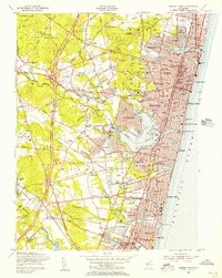
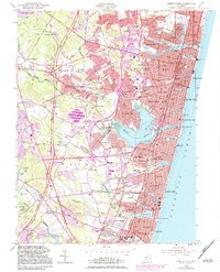
1954 Map of Asbury Park
USGS Topo · Published 1956About this map
Asbury Park and its surrounding coastal boroughs appear here during a period of significant post-war development along the Jersey Shore. The shoreline is densely populated from Avon-by-the-Sea up through Ocean Grove, featuring prominent landmarks like the Convention Hall and the Auditorium. Just inland, the Garden State Parkway cuts through the landscape, indicating the rapid expansion of transportation infrastructure that reshaped Monmouth County in the mid-1950s.
Find a feature on this map
160 named features on this map. Tap any name to fly to it.
Don’t see what you’re looking for? This feature index may not catch every label — zoom into the map to look around manually.
Map Details
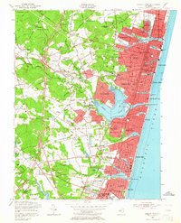
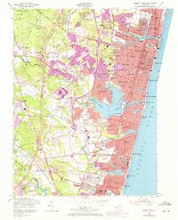
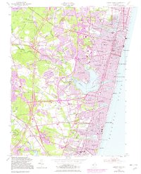
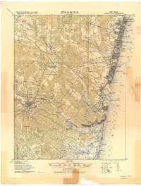
Editions of this 1954 Asbury Park Map
5 editions found
Other maps of this area

1888 · Asbury Park
USGS Topo · 1:62,500

1888 · Sandy Hook
USGS Topo · 1:62,500

1893 · Sandy Hook
USGS Topo · 1:62,500

1893 · Asbury Park
USGS Topo · 1:62,500

1901 · Sandy Hook
USGS Topo · 1:62,500

1901 · Asbury Park
USGS Topo · 1:62,500

1902 · Navesink
USGS Topo · 1:125,000

1918 · Sandy Hook
USGS Topo · 1:62,500
1919 · Asbury Park
USGS Topo · 1:62,500
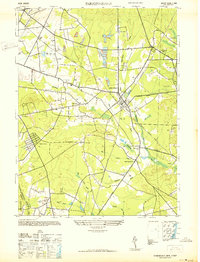
1942 · Farmingdale
USGS Topo · 1:24,000