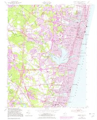
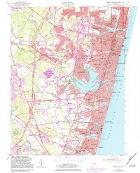
1954 Map of Asbury Park
USGS Topo · Published 1982About this map
The Atlantic coastline of central New Jersey is defined here by a series of coastal lakes and dense residential development. Inland from the resort communities of Asbury Park and Ocean Grove, the landscape transitions into the wooded basins of Shark River and Jumping Brook. The presence of the Asbury Park-Neptune Air Terminal and the Military Reservation Evans Signal Laboratory highlights the mid-century intersection of transportation and defense in Monmouth County.
Find a feature on this map
126 named features on this map. Tap any name to fly to it.
Don’t see what you’re looking for? This feature index may not catch every label — zoom into the map to look around manually.
Map Details
Editions of this 1954 Asbury Park Map
5 editions found
Other maps of this area

1888 · Asbury Park
USGS Topo · 1:62,500

1888 · Sandy Hook
USGS Topo · 1:62,500

1893 · Sandy Hook
USGS Topo · 1:62,500

1893 · Asbury Park
USGS Topo · 1:62,500

1901 · Sandy Hook
USGS Topo · 1:62,500

1901 · Asbury Park
USGS Topo · 1:62,500

1902 · Navesink
USGS Topo · 1:125,000

1918 · Sandy Hook
USGS Topo · 1:62,500

1919 · Asbury Park
USGS Topo · 1:62,500

1942 · Farmingdale
USGS Topo · 1:24,000