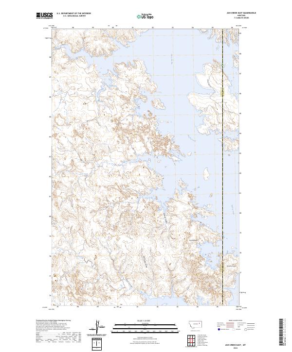
2024 Map of Ash Creek East
USGS Topo · Published 2024About this map
The Charles M Russell National Wildlife Refuge dominates this section of the Missouri River breaks, where the intricate shoreline of the reservoir meets the complex drainage systems of central Montana. The landscape is defined by the expansive Big Dry Creek, which feeds into the larger waterway, and a series of deep erosional features like Jawbone Coulee, Bell Coulee, and CBC Spring Coulee. These coulees and the high vantage of Daniels Point illustrate the transition from the high prairie into the rugged badlands topography of the region.
Find a feature on this map
20 named features on this map. Tap any name to fly to it.
Don’t see what you’re looking for? This feature index may not catch every label — zoom into the map to look around manually.
Map Details
Editions of this 2024 Ash Creek East Map
This is the sole edition of this map. No revisions or reprints were ever made.
Other maps of this area

1954 · Jordan
USGS Topo · 1:250,000

1956 · Jordan
USGS Topo · 1:250,000

1958 · Jordan
USGS Topo · 1:250,000

1964 · Jordan
USGS Topo · 1:250,000

1972 · Short Creek
USGS Topo · 1:24,000

1972 · Flat Creek School
USGS Topo · 1:24,000
1972 · Spring Creek Bay
USGS Topo · 1:24,000
1972 · Norville Creek
USGS Topo · 1:24,000

1972 · Ash Creek East
USGS Topo · 1:24,000
1972 · Ash Creek West
USGS Topo · 1:24,000