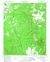
1947 Map of Ash Fork
USGS Topo · Published 1968About this map
Ash Fork serves as the primary hub for this mid-century portrait of northern Arizona's high country, situated at the junction of the Atchison Topeka & Santa Fe railroad and the early regional road network. The landscape is defined by the sharp transition between the Kaibab National Forest and the Prescott National Forest, where the county line between Yavapai and Coconino counties cuts across diverse terrain. The mapping reveals a sparse but strategic cattle and rail economy, marked by isolated outposts like Quarter Circle XX Ranch and Evans Ranch. Notable for its water management in an arid climate, the sheet identifies numerous named stock tanks and engineered structures such as Irishman Dam and Meath Dam. These features, alongside the telephone line and small sidings like Wood Spur and McLellan, illustrate the infrastructure required to support life and commerce along the rail corridor.
Find a feature on this map
50 named features on this map. Tap any name to fly to it.
Don’t see what you’re looking for? This feature index may not catch every label — zoom into the map to look around manually.
Map Details
Editions of this 1947 Ash Fork Map
3 editions found
Other maps of this area

1886 · Chino
USGS Topo · 1:250,000

1887 · Prescott
USGS Topo · 1:250,000

1891 · Chino
USGS Topo · 1:250,000

1892 · Prescott
USGS Topo · 1:250,000

1905 · Jerome
USGS Topo · 1:125,000

1922 · Williams
USGS Topo · 1:125,000

1944 · Clarkdale
USGS Topo · 1:48,000

1947 · Ash Fork
USGS Topo · 1:62,500

1947 · Simmons
USGS Topo · 1:62,500

1947 · Picacho Butte
USGS Topo · 1:62,500