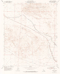
1955 Map of Ash Hill
USGS Topo · Published 1976About this map
Atchison Topeka and Santa Fe railroad tracks wind through the arid landscape of the Mojave, following the natural contours south of the Bristol Mountains. This 1955 survey documents a rugged corridor where transportation and extraction define the human presence. Industrial activity is visible at the Dictator No 1 Mine and a nearby Prospect, accessed via a rugged Jeep Trail. The map captures the infrastructure of the era, including a long Pipe Line cutting across the southern sections and the remnants of an Old Railroad Grade tracing a path parallel to the modern tracks. Small railroad-aligned points like Ash Hill and Klondike serve as isolated markers of the high desert passage. The prominent VABM 2237 Ash Hill provides a primary surveying point over this volcanic and mountainous terrain.
Find a feature on this map
11 named features on this map. Tap any name to fly to it.
Don’t see what you’re looking for? This feature index may not catch every label — zoom into the map to look around manually.
Map Details
Editions of this 1955 Ash Hill Map
2 editions found
Other maps of this area

1942 · Amboy
USGS Topo · 1:250,000

1943 · Amboy
USGS Topo · 1:250,000

1953 · San Bernardino
USGS Topo · 1:250,000

1954 · Needles
USGS Topo · 1:250,000

1954 · Bagdad SW
USGS Topo · 1:24,000

1954 · Ludlow SE
USGS Topo · 1:24,000

1955 · Ludlow
USGS Topo · 1:24,000

1955 · Morgans Well
USGS Topo · 1:24,000

1955 · Ash Hill
USGS Topo · 1:24,000

1955 · Broadwell Lake
USGS Topo · 1:62,500