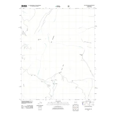
2011 Map of Ash Mountain
USGS Topo · Published 2011About this map
Ash Mountain and the prominent geological formation known as The Rock Wall dominate this high-altitude landscape in Colfax County. In the early 21st century, this area of the Valle Vidal serves as a significant recreational and ranching corridor, anchored by the settlement at Shuree and the Shuree Lodge. The map documents a network of Forest Service roads, including FR 1950 and FR 1910, which provide access to high-country features such as Windy Gap and the Cimarron Campground. Waterways like Middle Ponil Creek and McCrystal Creek carve through the terrain, connecting dispersed points of human activity such as Clayton Corral and the McCrystal Place. The presence of these named corals and lodges alongside major peaks like Little Costilla Peak reflects a modern era of land management where historic ranching traditions and public wilderness access coexist.
Find a feature on this map
29 named features on this map. Tap any name to fly to it.
Don’t see what you’re looking for? This feature index may not catch every label — zoom into the map to look around manually.
Map Details
Editions of this 2011 Ash Mountain Map
This is the sole edition of this map. No revisions or reprints were ever made.
Other maps of this area

1954 · Raton
USGS Topo · 1:250,000

1955 · Ute Park
USGS Topo · 1:62,500

1958 · Raton
USGS Topo · 1:250,000

1962 · Ash Mountain
USGS Topo · 1:62,500

1963 · Red River Pass
USGS Topo · 1:24,000

1963 · Comanche Point
USGS Topo · 1:24,000

1963 · Big Costilla Peak
USGS Topo · 1:24,000

1982 · Wheeler Peak
USGS Topo · 1:100,000
1986 · Vermejo Park
USGS Topo · 1:24,000
1986 · Van Bremmer Park
USGS Topo · 1:24,000