
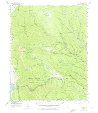
1955 Map of Ute Park
USGS Topo · Published 1957About this map
The historical Beaubien and Miranda (Maxwell Grant) dominates this landscape in the mid-1950s, defining a region where private land tenure and public wilderness management intersect. The northern Sangre de Cristo range is marked by a legacy of resource extraction, visible in the high-altitude Aztec Mine, French Henry Mine, and the Deep Tunnel Mine situated around the slopes of Baldy Mountain. The presence of Virginia City (Site) serves as a reminder of the area's gold rush era, while the extensive boundaries of the Philmont Scout Ranch signify the mid-century transition toward conservation and youth education. Along the Cimarron River, the village of Ute Park and the Cimarroncita (Girls Camp) reflect the local economy's shift toward seasonal tourism and recreation. From the Jackson Cem to the storied Black Jacks Hideout, the map documents a terrain where frontier legends and industrial ambitions shaped the canyons of Colfax County.
Find a feature on this map
71 named features on this map. Tap any name to fly to it.
Don’t see what you’re looking for? This feature index may not catch every label — zoom into the map to look around manually.
Map Details
Editions of this 1955 Ute Park Map
5 editions found

Other maps of this area

1954 · Raton
USGS Topo · 1:250,000

1955 · Cimarron
USGS Topo · 1:62,500

1956 · Tooth Of Time
USGS Topo · 1:62,500

1956 · Miami
USGS Topo · 1:62,500

1958 · Raton
USGS Topo · 1:250,000

1962 · Ash Mountain
USGS Topo · 1:62,500

1962 · Casa Grande
USGS Topo · 1:62,500

1963 · Eagle Nest
USGS Topo · 1:24,000

1963 · Red River Pass
USGS Topo · 1:24,000

1963 · Comanche Point
USGS Topo · 1:24,000